Map Settings and Access
Map settings
Select Map settings in the upper-right corner of a map. These settings apply to everyone who opens this map.
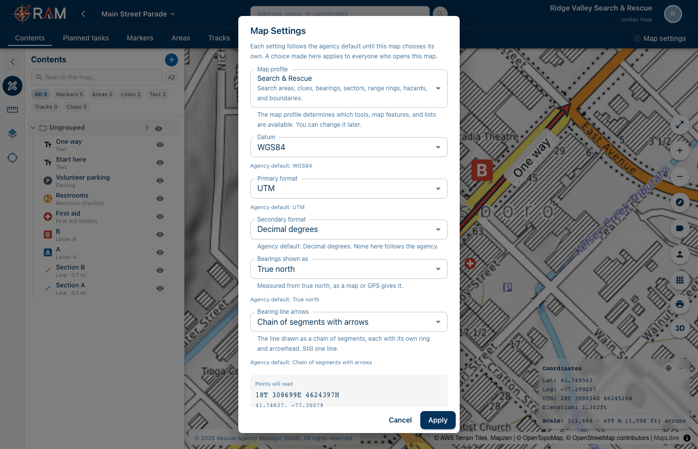
| Setting | What it does |
|---|---|
| Map profile | Search & Rescue or General. Decides which markers, drawing tools and lists the map offers. An operation's tabs, such as Subject or Organization, are set by its tools instead. See Tools |
| Datum | The datum positions are given in, such as WGS84 or NAD83 |
| Primary format | How positions are written: UTM, MGRS / USNG, Decimal degrees, Degrees decimal minutes or Degrees minutes seconds. The grid follows this |
| Secondary format | An optional second way to show positions |
| Bearings shown as | True north or Magnetic |
| Bearing line arrows | A chain of segments with arrows, or one line with an arrowhead at the end |
Under each setting, RAM says where it comes from:
- Agency default means the map uses the agency's setting.
- Set for this map means this map has its own. Select Use agency default to go back.
The box at the bottom shows how a position will read with these settings.
Administrators set the agency defaults under Agency Settings → Map Settings.
Who can do what
Your personal maps are yours in full, whatever your level. For agency maps, your administrator gives each member one access level. See Roles & Permissions.
| Access | What it lets you do |
|---|---|
| View | Open maps and look at everything on them |
| Contribute | On agency maps, add markers and clues, and change the ones you added: the name, the position and photos. During an operation, start and end the tasks you're on, and share your live track from the RAM mobile app. You can't delete anything |
| Create / Edit map content | Make agency maps. Change or delete anything on an agency map, including other people's items. Add lines, areas and text, lock and unlock templates, and import map files |
| Manage maps | Everything above, plus copy and move agency maps, start and end operations, accept offered maps, and archive or delete any agency map |
Agency admins can do everything, and always see restricted markers.
An action you can't use is shown greyed out, with the reason underneath. For example, with Contribute, Delete says "Deleting takes Create / Edit map content".
People outside your agency who join a map through a sharing link get the role on their link, on that map only: View, Contribute or Edit. Edit works like Create / Edit map content on that one map. It isn't Manage maps.
Maps that can't be changed
These maps are read-only for everyone:
- a map whose operation has ended
- an archived map
- a locked template
Their buttons are greyed out with the reason. A manager can Reopen operation, Return to the library, or Unlock template.